Loading... Please wait...


Our Newsletter


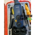
Topcon GLS 2200L 500 Meters 3D Laser Scanner

Price:
$19,250.00
Brand:
Shipping:
Calculated at checkout
Quantity:

Bookmark and Share


Product Description

Topcon GLS 2200L 500 Meters 3D Laser Scanner

The Topcon GLS 2200L is a high-performance 3D laser scanner designed for professionals requiring precise, long-range, and efficient data capture. With an impressive scanning range of up to 500 meters, this scanner is ideal for large-scale projects in construction, civil engineering, mining, surveying, and infrastructure development.

The GLS 2200L offers high-accuracy scanning, fast data acquisition, and robust environmental durability. It integrates advanced features such as automatic target recognition, high-speed data capture, and versatile scanning modes, ensuring optimal results across diverse project requirements.

Key Features:

  • Long-Range Scanning – Captures accurate 3D point cloud data at distances of up to 500 meters, ideal for large-scale environments.
  • High Accuracy and Precision – Delivers millimeter-level accuracy for reliable measurements and detailed 3D models.
  • Fast Data Acquisition – Scans at speeds of up to 120,000 points per second, significantly reducing field time.
  • Automatic Target Recognition – Simplifies the alignment and registration process, improving accuracy and efficiency.
  • Versatile Scanning Modes – Offers multiple scan settings for flexibility in data collection based on project needs.
  • Durable and Weather-Resistant – Built with an IP54-rated housing for dust and water resistance, ensuring reliability in harsh environments.
  • User-Friendly Interface – Easy-to-operate touchscreen display for efficient setup and real-time scanning control.
  • Seamless Data Integration – Compatible with Topcon MAGNET® Collage and other industry-standard software for data processing and visualization.

Applications:

The Topcon GLS 2200L 3D Laser Scanner is ideal for a wide range of industries and applications, including:

  • Construction & Infrastructure – As-built documentation, quality control, and progress monitoring.
  • Surveying & Mapping – Captures topographical data and landscape features with high precision.
  • Mining & Quarrying – Volume calculations, pit mapping, and surface analysis.
  • Civil Engineering – Road, bridge, and tunnel inspections for accurate modeling and analysis.
  • Industrial Plant Documentation – Precise scanning for maintenance planning and facility management.
  • Heritage & Archaeology – Detailed documentation and preservation of historical sites and monuments.

Specifications:

  • Scanning Range: Up to 500 meters (1,640 feet)
  • Measurement Accuracy: ±3mm at 100 meters
  • Scan Speed: Up to 120,000 points per second
  • Field of View (FOV): 360° horizontal / 270° vertical
  • Laser Class: Class 1 (eye-safe)
  • Data Storage: Internal memory with external USB data export
  • Connectivity: USB, Wi-Fi, and Bluetooth® for seamless data transfer
  • Control Interface: Touchscreen display with intuitive navigation
  • Power Supply: Rechargeable lithium-ion battery
  • Battery Life: Up to 5 hours of continuous operation
  • Operating Temperature: -10°C to +50°C (14°F to 122°F)
  • Protection Rating: IP54 (dust and water-resistant)
  • Dimensions: 220 x 210 x 400 mm (8.7 x 8.3 x 15.7 inches)
  • Weight: 12 kg (26.5 lbs)

Included Accessories:

  • Topcon GLS 2200L Laser Scanner Unit
  • Rechargeable Batteries and Charger
  • Tripod Mount
  • Carrying Case
  • Calibration Certificate
  • USB Cable and Data Storage Devices
  • Quick Start Guide & User Manual


Find Similar Products by Category


WRITE A REVIEW

Product Reviews

This product hasn't received any reviews yet. Be the first to review this product!