Loading... Please wait...


Our Newsletter


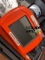
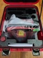
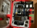
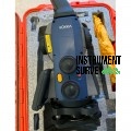
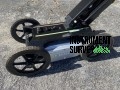
Topcon GLS 2000L 500 Meters 3D Laser Scanner

Price:
$16,350.00
Brand:
Shipping:
Calculated at checkout
Quantity:

Bookmark and Share


Product Description

Topcon GLS-2000L 500 Meters 3D Laser Scanner

The Topcon GLS-2000L is a high-precision 3D laser scanner designed for capturing detailed and accurate 3D data across a range of surveying, construction, and engineering applications. With a scanning range of up to 500 meters, the GLS-2000L offers superior versatility, speed, and accuracy for projects such as topographic surveys, as-built documentation, civil engineering, and infrastructure inspections.

This advanced laser scanner integrates dual-axis compensation, high-speed data acquisition, and automated target recognition, ensuring precise point cloud data even in challenging environments. The compact and lightweight design allows for easy transport and quick setup, making it ideal for both indoor and outdoor scanning projects.

Key Features & Capabilities:

  • Extended 500-Meter Scanning Range:

    • Captures precise data over long distances, ensuring flexibility for large-scale projects.
    • High accuracy of ±3.5 mm at 150 meters, ensuring reliable and detailed point cloud data.
  • High-Speed Data Acquisition:

    • Scans up to 120,000 points per second for efficient data collection.
    • Capable of full-dome scanning to ensure comprehensive area coverage.
  • Dual-Axis Compensation for Enhanced Accuracy:

    • Built-in dual-axis compensator automatically adjusts for tilt, ensuring consistently accurate scans.
  • Automatic Target Recognition:

    • Efficiently identifies and registers reference targets for streamlined data alignment.
  • Versatile Scanning Modes:

    • Supports multiple scan modes for flexible data collection, including high-speed, long-range, and high-resolution scans.
  • User-Friendly Operation:

    • Features a simple interface with intuitive onboard controls for easy setup and operation.
    • Real-time data viewing allows for instant verification and quality control.
  • Durable and Portable Design:

    • Lightweight and compact for easy transport and field deployment.
    • IP54-rated housing for dust and water resistance, ensuring performance in tough environments.
  • Seamless Data Management & Integration:

    • Compatible with Topcon’s MAGNET Collage software for efficient point cloud processing and analysis.
    • Supports industry-standard data formats for compatibility with third-party software.
    • USB and SD card connectivity for fast data transfer.

Applications:

Topographic Surveys: Capture precise terrain and landscape data.
Construction & As-Built Documentation: Create accurate models for verification and project management.
Civil Infrastructure: Inspect and analyze roads, bridges, and tunnels.
Industrial Facilities: Document plant layouts and complex structures.
Historic Preservation: Record detailed 3D models for restoration projects.


Specifications

General Specifications:

  • Brand: Topcon
  • Model: GLS-2000L
  • Type: 3D Laser Scanner
  • Weight: Approx. 11 kg (24.2 lbs) (including battery)
  • Dimensions: 210 mm × 395 mm × 250 mm (8.27 in × 15.55 in × 9.84 in)
  • Casing Protection Rating: IP54 (dust and splash water-resistant)
  • Operating Temperature Range: -10°C to +40°C (14°F to 104°F)
  • Storage Temperature Range: -20°C to +50°C (-4°F to 122°F)

Performance Specifications:

  • Maximum Scanning Range: Up to 500 meters (1,640 feet)
  • Accuracy: ±3.5 mm at 150 meters
  • Measurement Rate: Up to 120,000 points per second
  • Minimum Point Spacing: 3.6 mm at 10 meters
  • Field of View (FOV):
    • Horizontal: 360°
    • Vertical: 270°

Laser Specifications:

  • Laser Class: Class 1 (Eye-safe)
  • Laser Wavelength: 1,550 nm
  • Beam Divergence: 0.25 mrad

Tilt and Level Compensation:

  • Dual-Axis Compensation: Yes (±6° range for tilt correction)
  • Automatic Leveling: Yes

Data Storage & Transfer:

  • Internal Memory: Supports internal data logging
  • External Storage: SD card and USB flash drive support
  • Connectivity: USB 2.0 and Ethernet ports

Power Supply & Battery:

  • Battery Type: Rechargeable Lithium-Ion
  • Battery Life: Up to 5 hours continuous operation
  • Charging Time: Approx. 4 hours
  • Power Supply: AC adapter for direct power use

Software Compatibility:

  • Data Processing Software:
    • Compatible with Topcon MAGNET Collage for point cloud processing
    • Supports standard formats for integration with third-party software (e.g., AutoCAD, Revit, and other BIM platforms)

Additional Features:

  • Automatic Target Recognition: Yes
  • Onboard Control Panel: Intuitive interface with touch controls
  • Real-Time Data Display: Yes (for instant data verification)
  • Tripod Mounting: Standard tripod mount for stability and ease of use


Find Similar Products by Category


WRITE A REVIEW

Product Reviews

This product hasn't received any reviews yet. Be the first to review this product!